11:30 PM Update…
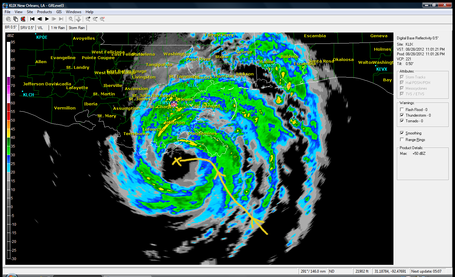
I’ve updated the Isaac rain probabilities for the KC region below. Isaac is still a hurricane with 80 MPH winds, and between the storm surge and the flooding rainfall it’s been an impressive category one hurricane down there that’s probably doing more damage that what is typical for these types of storms since it’s strengthening along the coastline. The storm made a brief landfall across far SE LA earlier this evening @ 6:45. As it did so it started wobbling westwards and now it seems to be drifting westward. Here is a radar look at about 11PM, showing the center of the storm.
The latest computer models are suggesting this westwards motion may continue for awhile through at least most of Wednesday. It’s possible this may skirt the LA coastline for the next 24 hours or so creating more heavy rainfall down there due to the slow movement of the storm. This is also significant because the farther west this goes the HIGHER the chance of it coming closer to the KC area, increasing our rain chances and the rainfall totals. The latest data indicates the rain may move through the region in several bands starting later Friday night. Here is the NAM model run showing the forecasted rainfall associated with the storm.
The rainfall forecasts are impressive down there and getting more interesting the farther into MO you go.
More tomorrow AM with KR and blog updates.
CHANCE OF ISAAC AFFECTING OUR WEATHER WITH A TRACE OR MORE: 65%
CHANCE OF ISAAC AFFECTING OUR AREA WITH OVER .25″ OF RAIN: 35%
CHANCE OF ISAAC AFFECTING OUR AREA WITH WIDESPREAD 1″+ OF RAIN: 25%
ALL CHANCES ARE HIGHER OUT TOWARDS THE LAKE OF THE OZARKS THROUGH CENTRAL MO
Hurricane Isaac was upgraded earlier this afternoon and may still be strengthening per the latest recon into the storm. This is not surprising as these types of storms have a tendency to increase somewhat in strength as the frictional effects of land come into play. Slow moving storms like this tend to slow even a bit more increasing the rainfall in the affected areas.
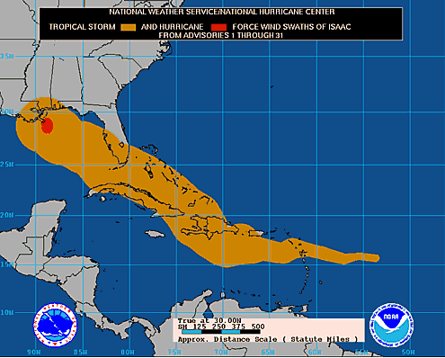
As of this writing Isaac has winds of at least 80-90 MPH and is located about 100 miles SE of New Orleans. It should make landfall sometime in the early AM on Wednesday as it continues it’s rather slow NW movement. Here is the latest track for the storm. Although technically it’s making landfall now along the mouth of the Mississippi.
The storm will weaken later tomorrow morning as it continues it’s journey.
Rainfall is obviously going to be heavy to extreme down there and the slow movement of the storm will not help at all. Projections are for 10-20″ (some have already had close to 8″. Here is the storm total estimate from the NWS radar in New Orleans.
Next let’s track the progress of Isaac.You can see the eye on radar as of this writing in the far SE part of LA along the other bayous. You can loop the radar by clicking here.
So what about the rainfall potential the farther north you? Here is the latest forecast.
You can clearly see that the forecast track clearly favors (at this point), central and eastern MO for the heaviest rain out of this.
The good news is some of the forecast models are suggesting that we could see a slightly farther west track that would enable our region to get a bit more rainfall out of this. So at least there is potential. As the earlier blog showed you however; this is a rare occurrence for this part of the country so that is concerning. Never say never though in the world of weather but there are still many unanswered questions concerning how much rainfall we can get here, especially on the NW side of the storms path. It also will be breaking up as it moves farther northwards. The 12Z GFS gave KCI close to 1.3″ while the 18Z backed off to about .9″.
Here is one of the last visible pictures of the storm before the sun sets…
Joe