I’ve been doing quite a bit of research on this and this blog will be dedicated to the research I’ve done. A lot of you lean into the more weather aware of the readers…which I understand. The overall purpose of this research is to get my findings out…to have something that I can have some of my colleagues at the various NWS local offices to look at and also to have some emergency managers in the area to read as well. I have no overall answer to how to do things better…and I definitely have NO gripe or concern about how the NWS issues severe thunderstorm warnings right now. They have a mandate from NOAA so their jobs are clear. I want to stress that point again.
Let’s do a poll and see what you think about the subject matter of the blog:
Next question:
First though a little definition and history. A severe thunderstorm warning is issued when a thunderstorm has the ability or is producing wind gusts of at least 58 MPH and 1″ hail. They ARE NOT issued because of lightning frequency or the rate of heavy rainfall that is accompanied by the individual storms. About 7 years ago (here in parts of the Plains if I remember correctly…the hail criteria was increased from 3/4″ to 1″ (quarter size) in an effort to bulk up the impact of the individual warnings. If memory serves the initial severe thunderstorm warnings were first issued in the 1960s, essentially mainly for aviation concerns…little has changed in the initial criteria since then.
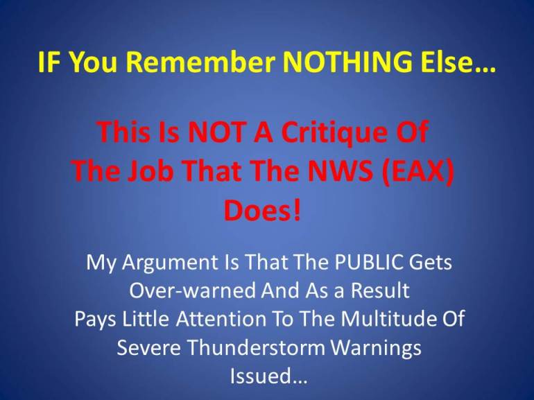
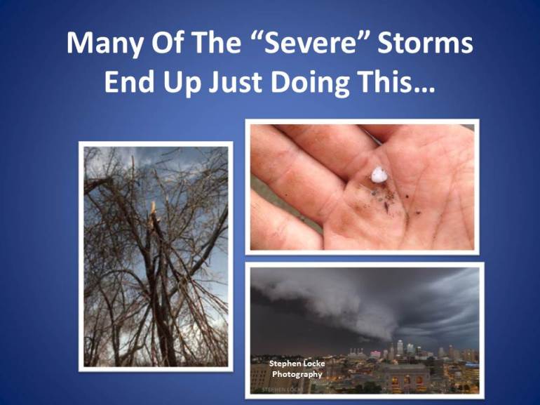
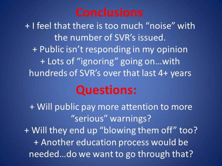
That, in my opinion is part of the issue. My thought process as the slides I’ll be displaying is that the severe thunderstorm warning, as we know it today, despite the increase in hail size about 5+ years ago nationwide…is overused. My feeling is that the vast majority of “regular” people (our audience) has become numb to the numbers of severe thunderstorm warnings issued throughout the course of a spring and summer especially.
My focus for this project was the number of severe thunderstorm warnings issued by our local office serving the majority of our counties…that would be the office in Pleasant Hill, MO. The other office that serves a handful of our counties is the NWS in Topeka. I visited with them this past weekend and talked about my research in vague terms and I thank them for the input as well.
This is being done with the knowledge of some of my colleagues at the NWS in Pleasant Hill as well as their higher ups in the Central region (responsible for all the NWS offices in the Midwest/upper Midwest roughly) and also some of the local emergency managers in the area (EMs). To reiterate…I’m not sure what we have here…but I’m increasing convinced what we have here can be improved upon.
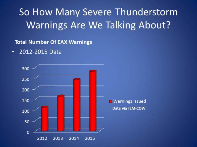
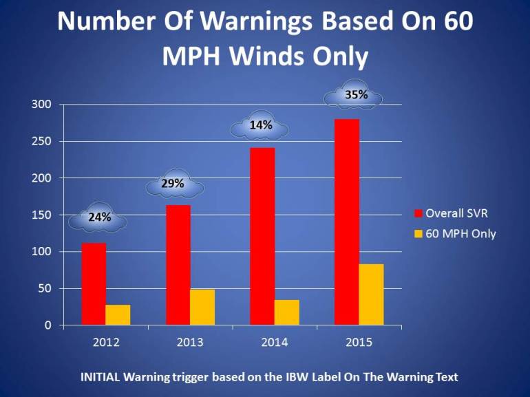
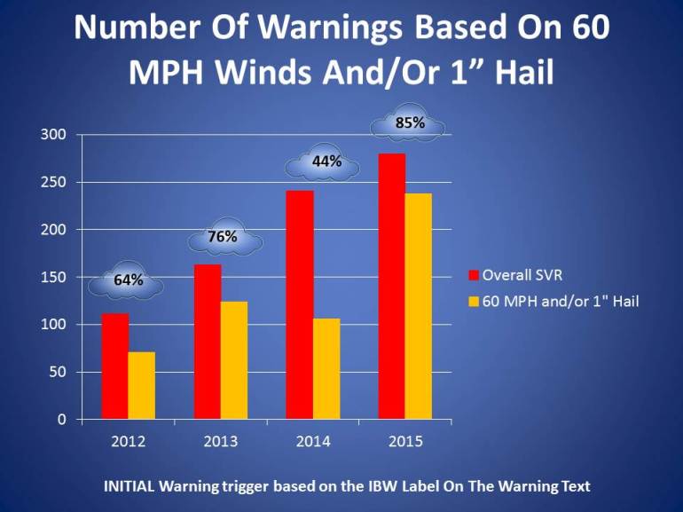
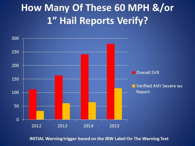
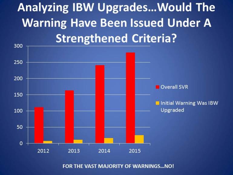
So would it surprise you that over the past 10 years or so the NWS in Pleasant Hill issued over 2000(!) severe thunderstorm warnings. That takes into account the change in hail criteria as well. I decided for the sake of NOT losing my sanity to look at the past 4 years. 2012 through 2015. My resource was the IEM page via IA State. I analyzed every warning issued in that 4 year span…looking for the reason why it was initially issued…how many counties were involved in the warning…whether or not the warning was “strengthened” or “weakened” in subsequent updates (in other words did the storm, which caused the initial warning get stronger or weaker) and also whether or not the storm actually produced the expected severe weather (the reason why a severe thunderstorm warning was issued in the first place).
Here are the slides that I’ve created so far…oh and my powerpoint skills are terrible and I readily admit that :)

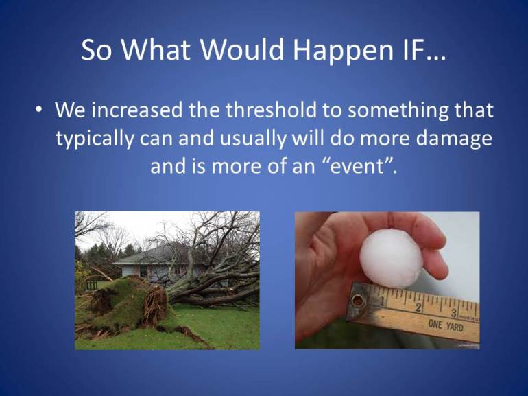
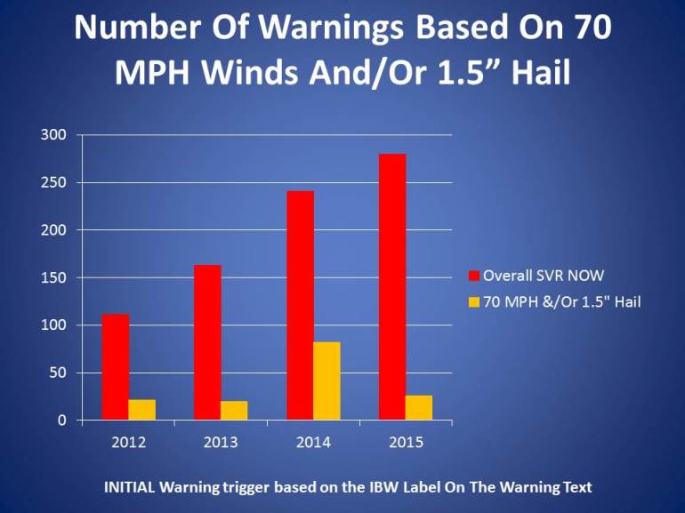
OK so a lot to digest. When I first approached this…I thought a way of going about this (strictly from a media standpoint imo) was to have the NWS issue (for lack of a better phrase) an “Enhanced” severe thunderstorm warning for a stronger type storm for example 70 or 75 MPH winds and/or 1.5″ to 1 3/4″ (golfball size) hail. Why I thought of this is that I thought strictly from a broadcast perspective…IF I’m on the air and we’re showing you numerous counties color coded in yellow showing severe thunderstorm warnings, for example with a large squall line coming through, and IF there was a part of that line that was showing stronger indications of potency…that a NEW warning could be issued, based on this stricter criteria, that would alert me on the air and you, our viewer, with a different colored part of a particular county or counties (aside from the basic sever thunderstorm warning color) that this part of the storm or this part of the line of storms is particularly dangerous and not (“run of the mill”).
In conversations with my friends at the NWS…there was a general feeling that the chances of adding a NEW layer of warnings on top of what we already have may be a non-starter. The NWS is trying to reduce the number of various advisories that are going out already (hopefully some changes down the road to the crazy number of different flood advisories/warnings that are issued).
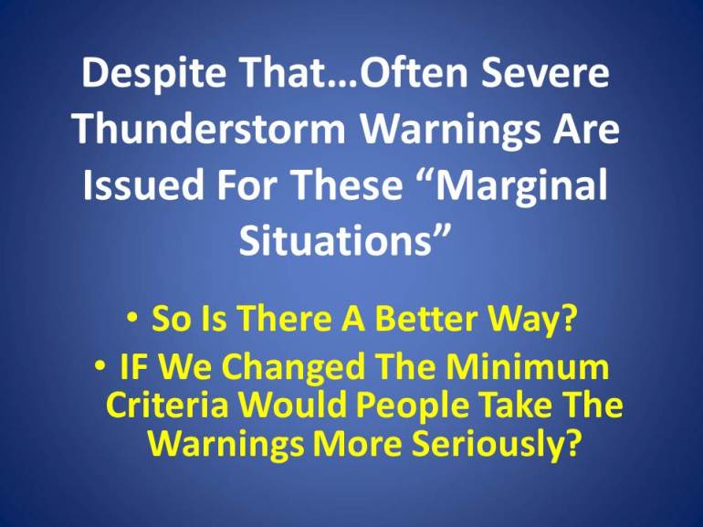
There was some input to me about perhaps looking to strengthen the initial warning criteria…hence the basis and reason for the research. In my heart I still feel that a NEW layer is the way to go (due to various factions feeling like things shouldn’t change in various regions of the country). With that said I would certainly welcome a stricter initial criteria.
Other NWS people have told me, well that is all well and good in the Plains where we see hundreds of storms a year and we’re pretty conditioned to storms and what they do but in other parts of the US, especially back east and into the Great Lakes and perhaps out west…they don’t experience the quantity of storms that we do plus as my colleagues from Topeka pointed out to me, back east there is definitely more tree coverage than here in the Plains…they may be more sensitive to tree damage/knocked over trees that we are here. All valid points.
So perhaps we look at different requirements for severe storms in various regions in the country. I think that might get confusing…then again when the middle part of the country went from 3/4″ to 1″ hail on an experimental basis they system didn’t crumble and the public was no less served in my opinion.
I’m sure these thoughts may generate some discussion within the NWS (good and bad perhaps) which really was the point of the whole process. I don’t have answers to all things and I need more input from the NWS and also especially from the Emergency Managers. We are the customers to the NWS and perhaps as customers we may have a different feeling about these things than the NWS has.
One thing for sure there is no easy solution and perhaps (probably-I’m not afraid to say) nothing will change in the end. One thing though about myself…I LOVE conversations about these things…if I’m crazy…fair enough…I think many might say I’m onto something but they’re just not exactly sure what it is…and perhaps that’s the way I feel as well.
The end result is that I want you to be warned, and have confidence, that what we say may happen will happen when it comes to severe thunderstorms especially. I want those warnings to bear “fruit” which I think has a better chance of happening with a firmer initial criteria. I want you, our viewer to pay more attention to severe thunderstorms but I realize that with hundreds issued for many ( think) it just turns into blah…blah…blah.
Thanks for taking the time to read through this…I hope, if nothing else, you think about the current way the NWS does things…and IF you’re happy with it…great! If not…perhaps there can be some conversations about doing something different.
Joe