Another hot and a bit of a humid day for the region…really not only today but tomorrow as well. We hit 94° again yesterday…for the 4th time this year…we cant seem to get above that for whatever reason and it remains the hottest temperature so far for KC this summer.
Rain chances will be increasing to some extent starting later tomorrow night into Saturday morning…although coverage may not be so great. Sunday should be OK but overall the weekend won’t be as hot…with temperatures about 10° cooler…so that is some good news heading into the weekend.
Better chances will come next week…especially Monday and perhaps Tuesday as well for parts of the area…we need it for sure as it’s been really dry for the last couple of weeks.
Laura came ashore last night with landfall near Cameron, LA. The strongest wind gusts appear to be around Lake Charles with gusts to 132 MPH. There is a disconnect however about the “true” strength of the storm…more on that in the discussion.
_________________________________________________________________
Forecast:
Today: More sunshine north with more clouds south. Highs 90-95° north side with temperatures a few degrees less hot farther south of KC with the extra clouds.
Tonight: Fair and mild with lows near 70°
Tomorrow: Mostly sunny and hot with highs back into the lower>mid 90s
This weekend: Cooler…mid 80s. There may be a few showers early Saturday morning but overall the weekend looks dry right now.
__________________________________________________________________
Discussion:
Let’s start with Laura…the highest wind gusts were near 132 mph in Lake Charles at the airport there. Numerous areas around there saw wind gusts of 100-120 MPH…again the key here is the gusts were that strong.
Here’s the rub though…when hurricanes are assigned a category number…for example…Laura was a category 4 hurricane at landfall (150 MPH winds (allegedly sustained and NOT in gusts)…it is based on sustained winds…values which should be more common if you will (assuming the instrumentation is correct).
So far though…the strongest winds that were sustained and NOT in gusts…have been closer to 100 MPH…which would be higher end category 2 strength and NOT category 4 strength. Here is the breakdown about the wind strength that goes into assigning the categories…
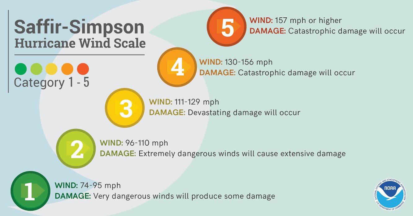
Again these categories are based on sustained winds and not the gustiness to the wind. There is a big difference.
Now can there be stronger sustained winds with hurricanes? Sure…the issue usually comes down to are there enough sensors in the path of the storm…and the answer is usually no. Whether because of a lack of airports with weather instrumentation or whatever. Recently various organizations that are doing research into the strength of winds have placed their own sensors (which are pretty reliable) in the path of the storm to get a better picture of what reality is.
There is also an issue about instrument failure. This can happen and would then result in missing data points about the true strength of the winds.
No doubt there is a lot of damage…so far..a.t 1st glance mostly wind related. The storm surge is believed to be at least in the 9-12+ foot range…so let’s see what happens as we get a better view of the likely widespread damage towards the sparsely populated coastline during the course of the day. The highest surge was likely in an area that didn’t have any instrumentation.
Here is Laura now…with the storm slowly spinning down.


There may be some rain towards southwestern MO from this today but for us in KC…just some clouds especially on the south side of the Metro and southwards.
Rain totals off the HRRR model into daybreak Friday show heavy rains and flooding rains likely into AR…and perhaps SE MO as well but nothing for the Metro from this directly.
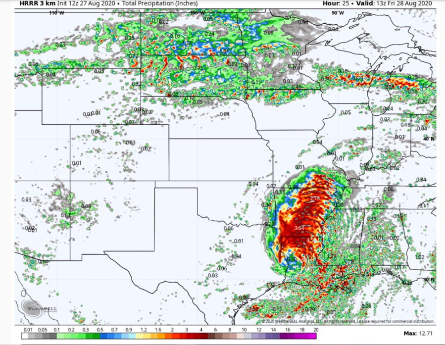
Here is the latest information…

OK so what about us? Well as mentioned there will be more hot weather into Friday…then a change thanks to a cold front coming through. There actually could be some strong storms later tomorrow night across northern MO…we’ll see how well they hold together into Saturday early morning. There will be cooler weather though so that should be some relief for us…
So while there may be some showers early Saturday…the better chances appear to wait till Monday as the front retreats northwards the the dew points really start to pop again. Hopefully that will be a decent rain for many because it’s awfully dry out there as I’ve mentioned about 10 times this week!
More on that tomorrow. The feature photo today is from Donna Barron…

Joe