
The good news is that this will be a short-lived cold outbreak…the bad news is that it’s really cold out there and today will remain cold and blustery. Tomorrow will start just cold…but then we start to modify as the coldest air starts to move away from the region.
No significant winter storms are ahead…although there is a system coming on Monday that bears watching just in cast…especially for northern MO.
_________________________________________________________
Forecast:
Today: Mostly sunny with some clouds moving through in the afternoon ,and cold with highs in the teens
Tonight: Bitterly cold with lows near 0°
Tomorrow: Mostly sunny and chilly with highs well into the 20s
This weekend: Milder…40s on Saturday and 50s on Sunday
_________________________________________________________
Discussion:
We’re snow and ice encrusted right now…after 1-3-ish” of snow moved through the region. There was actually more snow but it kept melting and compacting…thanks to temperatures in the 33-35° range. The melting on the roads was the most beneficial…as the pavement was just mostly wet all day long. So the expected no impacts to the roads facet to the forecast was accurately projected.
Overall all the impacts from the storm were correctly predicted…including the higher end, near 4″ totals, across areas a bit farther south of KC.
The cold air is here now…and it is cold. At least 3° this morning. You can see the core of the arctic air across the northern Plains this morning.

The system came through with snow…and there has been a nice snow swath through the region.

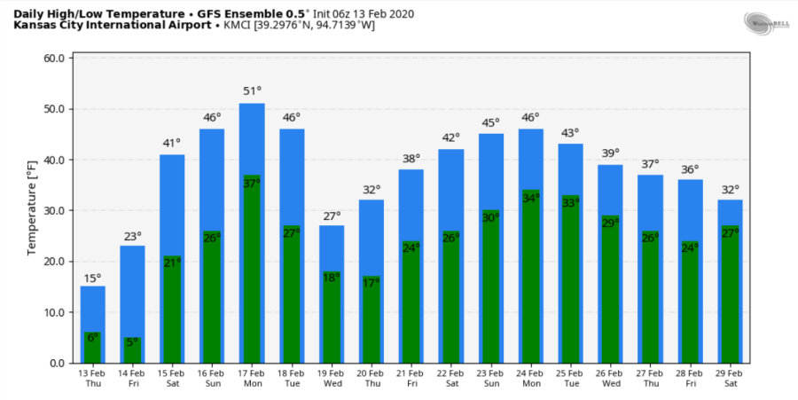
The combination of the snow and the bitterly cold air mass in place is a bad combination for warming up. So we stay cold through tomorrow. The average highs are in the low>mid 40s. We won’t come close to that today.
In a winter though that has been marked by the inability to lock into cold air for any prolonged period of time this current air mass will also leave us…starting tomorrow evening as south winds take hold…allowing temperatures to remain more or less steady tomorrow night and warm up a bit more and start the snow melting on Saturday in earnest.
IF it wasn’t for the snow…we’d be in the 50s on Saturday. Once the snow melts though…it should go quickly because of the high water content…so while there will still be snow around on Sunday…it should be mostly in the shaded areas…and we should warm into the 50s to finish the weekend.
The 3.1″ @ KCI made this storm the 2nd highest snow system this winter in KC…and now our snow season total is up to 17.2″…that’s about 1.5″ below our seasonal average. Last winter we had just over 29″. Would I be shocked if that was winters last big hurrah…not really.
The pattern overall isn’t looking all that great for snowstorms locally for awhile and as we approach the end of the month in the data…there isn’t a lot showing up as prospects. We’ll go up and down for temperatures for the next 10 days…and while I don’t want you to take the data below as set in stone (obviously)…it actually doesn’t look too bad for trends…we’ll see about the Monday system.
From a snow perspective…here is a look at the EURO ensembles…and it doesn’t look all that great.
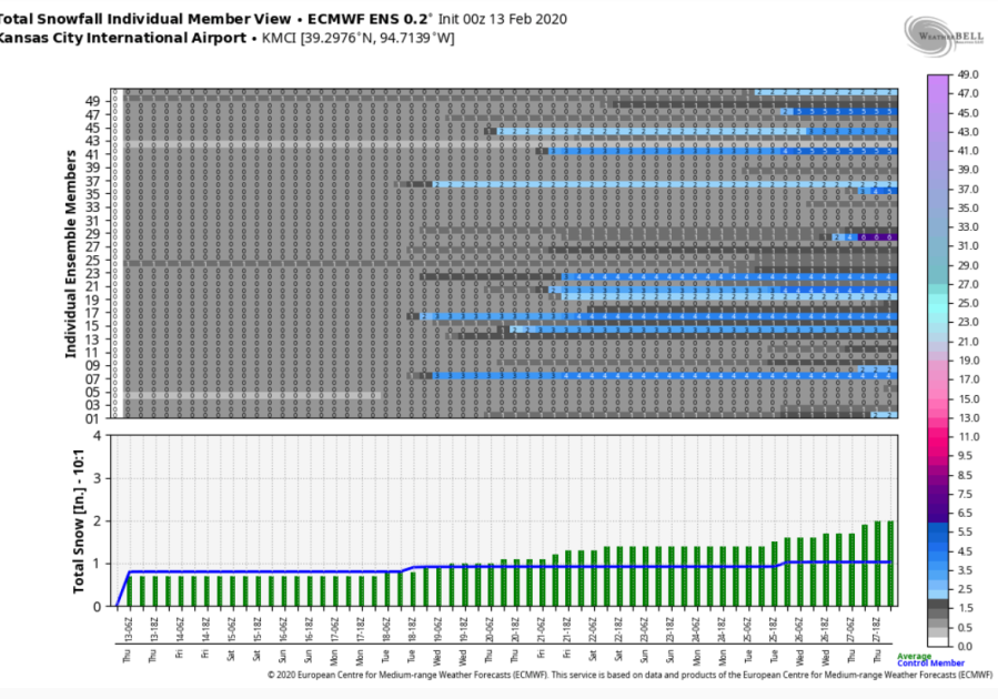
Some of the runs are picking up on something next week…but nothing to confidence building at this point.
We’re running 3.8° above average for the month…so odds are even with this 2 day cold weather shot…we’ll go through the rest of the month and end up above average for February.
Coming up in the blog tomorrow…assuming the Monday system isn’t that great…something that emergency managers and those with lightning interests may be interested in. I have data from the KC Metro counties going back over the last 30 years or so…and I’m going to show you the highest risk of lighting by the time of day and by the month. Some amazing stuff I came across yesterday that I think some of you will find fascinating!
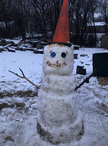
Our feature photo come from Vanessa Calderon…it was good snow making snow yesterday.
Joe


