
We’ve gotten off relatively easy so far this summer, amidst all the chaos that is 2020. Typically, we would’ve had plenty of Excessive Heat Warnings with highs near or over 100 degrees along with days of almost unbearable humidity by now. That just hasn’t happened so far. This latest quick round of heat has summed up the season so far: Hot and humid for sure, but we’ve seen SO much worse.
Along with the quick round of 90s, the humidity has consistently been rising with each passing dry day. Rising humidity means more water vapor in the low levels of the atmosphere close to the ground. As the amount of water vapor increases, the harder it is to warm the air. So, we’ve noticed a couple of instances of days of mostly sunny skies producing basically the same high of 94 degrees or so. Last July is a good example. The last few days is another one.
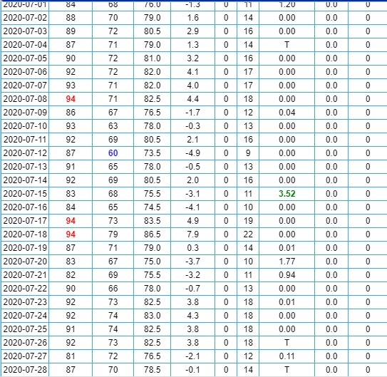
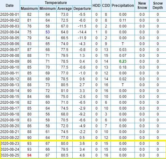
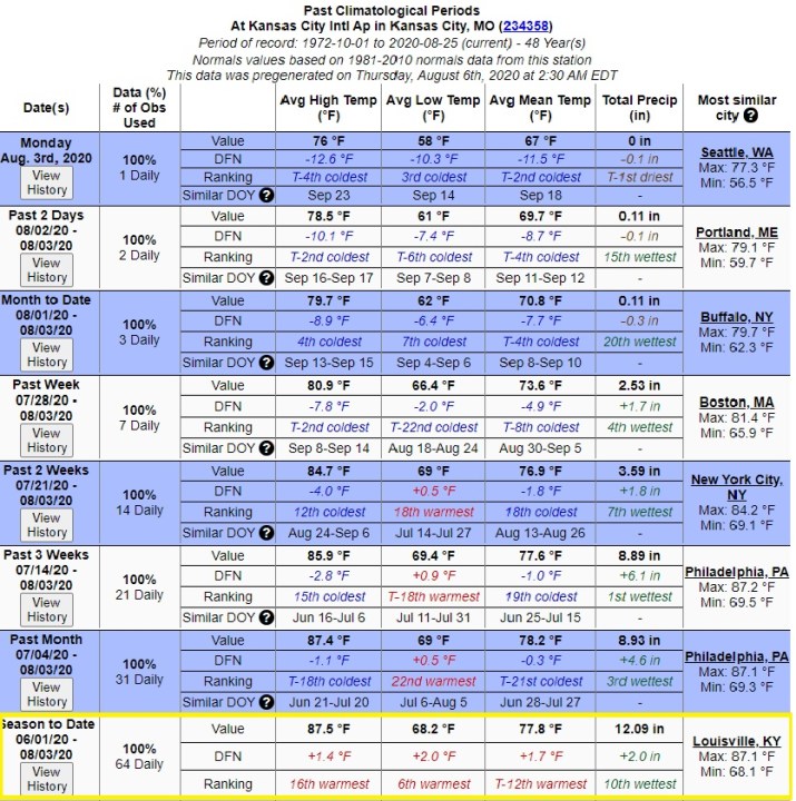
94 degrees has been the hottest high temperature, officially, out of KCI this summer, and we’ve gotten to that number exactly 4 times, as of yesterday the 25th. Today, we’re forecasted to hit 94 again, with only cooler temps afterwards. So, this summer could’ve been way hotter. In fact, this season-to-date has only been the 12th warmest on record, when looking at average mean temperature and only 16th warmest when looking at average high temperature.
So, what about the rest of August? What about September? Well, our Long Ranger through September 1st and the long-range forecast coming out of the Climate Prediction Center show the cooler-than-normal trend coming back.

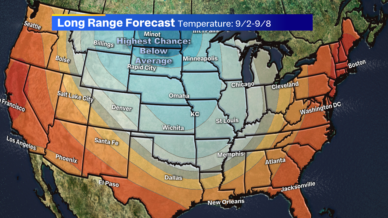
Average highs from now through September 8th range from 86 to 82 degrees. That means mid to low 80s (possibly upper 70s on rainy/cloudy days?) will be in the upcoming forecasts, which would be a nice taste of comfortable fall weather to enjoy around and after Labor Day weekend. Keep that in mind moving forward, tell your friends that the heat will be gone soon, and stay up-to-date with our latest forecasts on FOX 4!


