This year has been weird to say the least. And, this summer has followed in the same path as 2020. Typically, late July into the first week of August is supposed to be our hottest time of the calendar year. But, in 2020, just like in plenty of other ways, things haven’t panned out the way they were supposed to.
So far this month, temperatures have been relatively cool, with no 90-degree highs out of KCI and 3 days of 70-degree weather from the 3rd through the 5th!
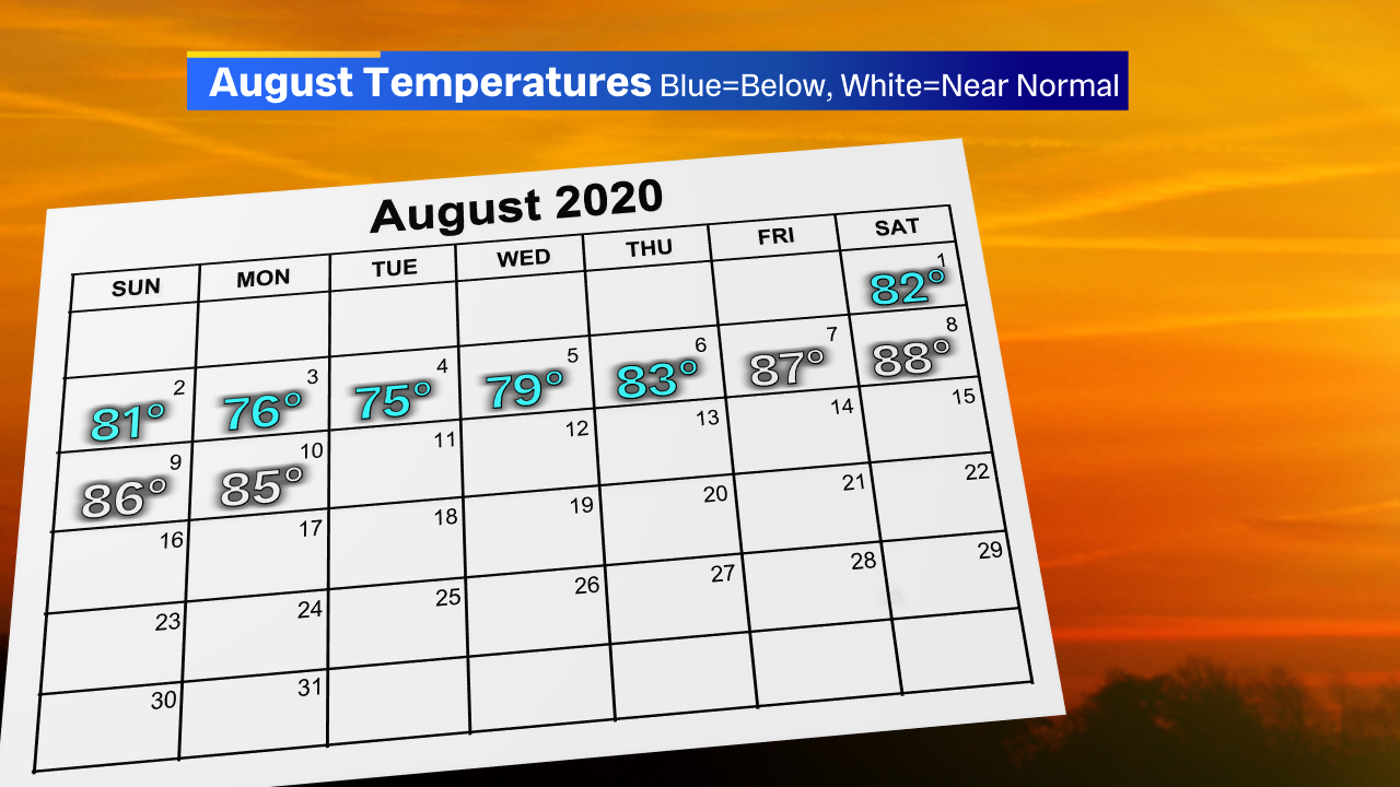
In fact, the first 10 days of the this month have been one of the coolest stretches to begin any August in KC weather history!
Lately, we’ve been caught in a pattern of stalled fronts overhead/around the KC Metro, aiding in increased clouds and scattered storm chances, followed immediately by high pressure spilling into the middle 1/3 of the country from Canada. That combination has managed to continue to keep the 90s down in southern Missouri and Kansas at the moment.
So, will there be a change later this month? Well, don’t expect much. Our Long Ranger keeps highs in the mid to upper 80s for the rest of the week and into the weekend (keep in mind our average or normal high this week is 88 degrees). And our long-range models continue to hint at cooler weather for the first half, if not most, of next week. Also, if you peek at the NWS tweet above, that 3rd week of August doesn’t show any warming signs.

If you don’t like the heat, this may be the best news you’ve heard today! If you want typical summer KC weather, there’s still that last week of August to get through. We’ll be watching for any changes as we move throughout the rest of this month on FOX 4!


