Good evening! We’re Weather Aware overnight Friday into Saturday because as this stationary boundary approaches, strong to severe thunderstorms with heavy rain are possible.
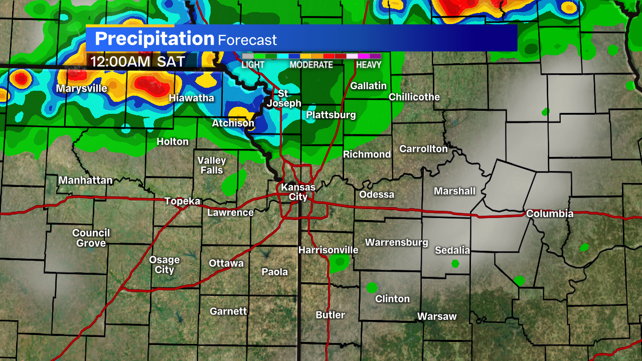 We’re going to have to be a bit patient, however. I think it’s well after midnight until this stuff even starts to fire up.
Once they do, they’ll fill in a bit to the west and migrate south. This looks to be our best window for severe weather.
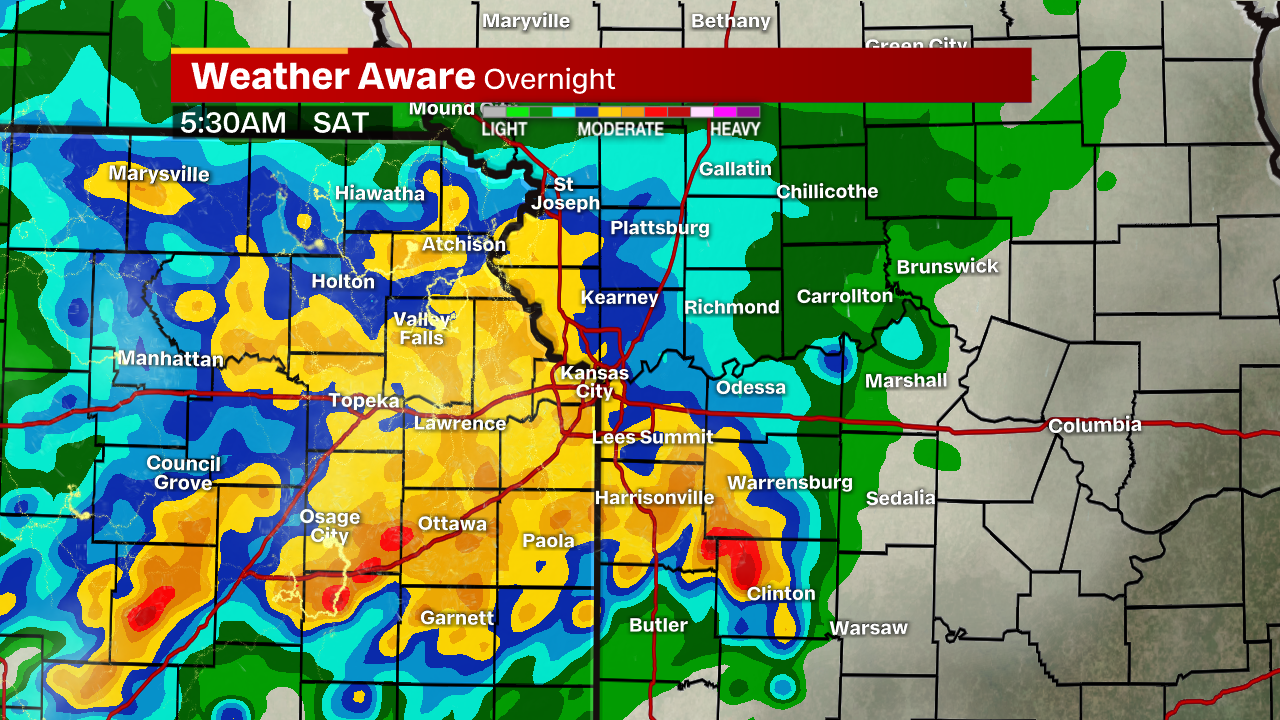
By the time we’re up early Saturday morning, most of us should be involved in more of a widespread rain at this point. It will gradually taper to scattered showers and storms by mid-morning.
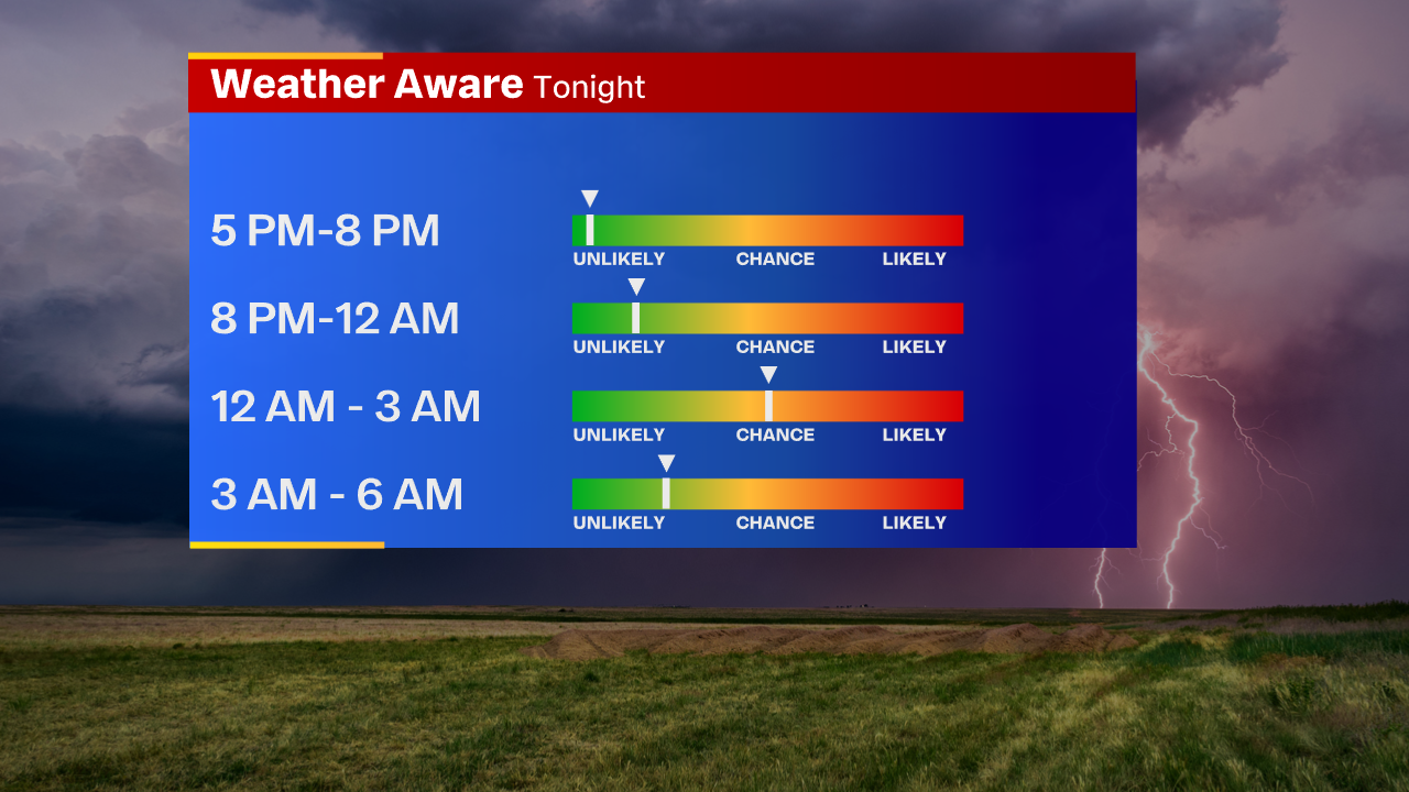
While rain is a possibility in the overnight hours, I think our best bet for anything severe would be between 12-3 a.m.
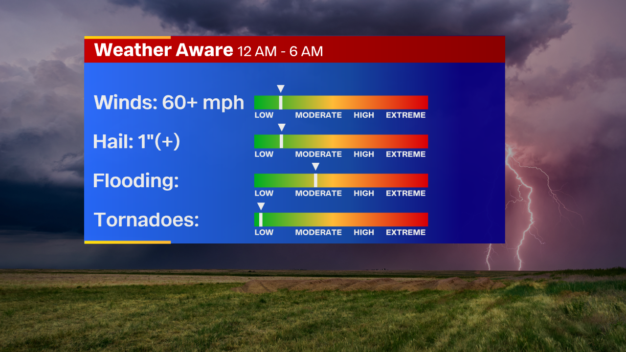
I’ve lowered wind and hail among the highest of the main threats. Not just because they’re slightly less likely, but because I think this is turning into a rain driven event.
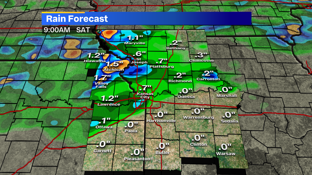
By Saturday morning, a few areas could see between 1/4-inch or over 2 inches of rain in a few locations!
Don’t get hung up on the specifics, just the general consensus of the potential for scattered heavy rain (for a change).
We’ll keep you posted on the severe threats overnight!


