
Well it was nice while it lasted…the lower dew points…the below average temperatures…the coolest first 5 days of August in KC weather history going back more than 130 years…even a record low. Now it changes. It’s going to get very sultry…pretty hot…pretty windy and in general…pretty much back to summer.
Rain chances will be returning as well…and while Friday has the best chance of rain for about 5 days…rain chances will be with us off and on in a more summer fashion (scattered) than not.
Welcome back to summer.
________________________________________________________________
Forecast:
Today: Some rain moving through the area around lunch…it will be light but there will be some rain then turning partly cloudy and milder. Getting muggier too in the afternoon with highs in the mid 80s and dew points increasing well into the 60s…you’ll start feeling it this afternoon.
Tonight: Dry through midnight…then increasing pre-daybreak storms in the region. Some brief locally heavy rains possible. Lows in the upper 60s
Friday: Storms linger for the 1st part of the day. There is still a question about how widespread this will be. Highs well into the 80s with muggy weather in the afternoon
This weekend: Best storm chances (more scattered) are in the morning hours. Most of the daytime hours will be dry overall. Hotter and windy. Winds gust to 25 MPH+. Highs 90-95° with lows in the low>mid 70s.
__________________________________________________________________
Discussion:
So we had it pretty good for a few days…now summer comes back. Hotter weather…and a lot more humidity will be characteristic of the region for the next 5 days or so, if not longer.
The cooler and refreshing air mass is now moving away from the central US…south winds are returning and that will tug up the moisture from the south gradually. This increases the dew points and that makes things feel more and more muggy.
Winds will also be increasing quite a bit starting tomorrow, but especially into the weekend. Gusts to 30 MPH will become more frequent in spots too…so yeah…here comes summer.
The transition really starts today as the moisture increases a bit more thanks to more of a south wind in the area. Then tonight, above the surface, strong winds will be developing around 5,000 feet or so and blowing towards KC. Look at the following map, it shows the strong winds pointing right at the KC Metro area at around 4PM. The core of those winds are over 60 MPH and again we’re right on the leading edge. The map is valid at 4AM
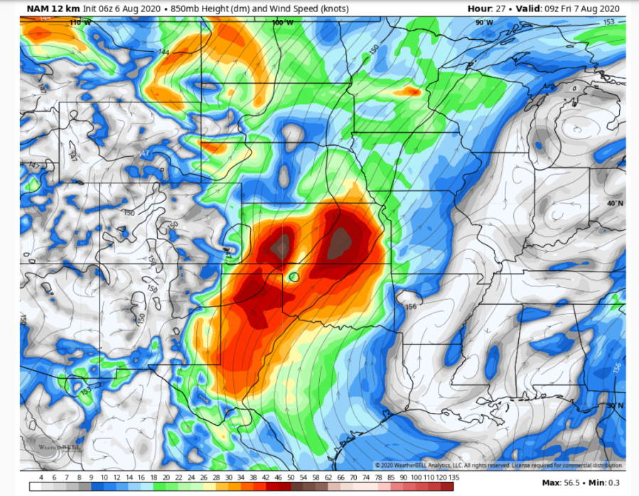
Why is this important? Well those winds help to create lift. The lift gets clouds to form and develop vertically. With enough lift…those clouds turn into rain and storms…and there should be plenty of lift to get things going later tonight.
When the storms form they should move towards the west-south-west. The most likely area of formation is across eastern KS and western MO. This low level jet stream will linger into the morning before rapidly fading later in the morning…so the lift to the atmosphere will be winding down quickly after 10AM and the rain will fade I think.
Rain amounts will vary from about a tenth of an inch to over 1 1/4″ in spots. It just depends on where the storms set up and where the heaviest downpours move in. Model solutions vary by a county or three with regards to the exact placement of the heaviest rains.
From a timing standpoint it appears the chances really go up after about 2-3 AM Friday.
After the rain ends tomorrow, you may notice the winds starting to increase. This will be a sign that things are really changing with regards to the way the hotter air will be expanding through the Plains. This continues through Friday night and as we get quicker sunshine on Saturday and with temperatures just above the surface closing in to the mid 80s (again above the surface) and with 25-30 MPH winds cranking away we should see temperatures at the surface pop into the lower 90s.
With the wet ground…the green terrain and the high dew points this will send the heat index into the 100-105° range. So it’s time to sweat again. The rain chances over the weekend aren’t the greatest. There may be some scattered storms Saturday morning, especially on the MO side…then on Sunday there may be the typical isolated storms in the mid to late afternoon.
Additional rain chances come early next week, especially Tuesday with a disturbance coming down from the west north west.
It will remain pretty hot and humid into next week, although there may be a day here or there that clouds and the rain chances may keep highs a bit less hot.
So welcome back to summer.
Final item. Yesterday the researchers at Colorado State came out with an updated tropical named storms forecast. So far we’ve had 9 named storms. 5 landfalls in the US, which are both crazy high numbers for the 1st week of August. The average for a whole season is 12 named storms.
Their revised forecast was unique. They’ve never predicted so many named storms before, which IF it bears out would mean we’d run out of names and have to move to the greek letters.
That’s a LOT…and the folks back east have sort of had it already. Isaias has done quite a bit of damage to the power system in the northeast part of the country. Many of the hardest hit areas were on the eastern side of the storm…and that is the worse side of these systems but because of the interaction with the same features in the atmosphere that created the cooler weather locally in the Plains…it’s wind field was more prolonged and expansive. Millions lost power…and many are still without power this morning, a few days after landfall.
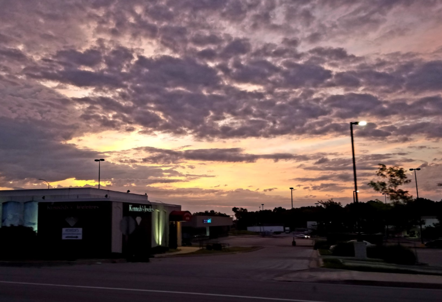
Our feature photo today is from BlueSpringsWx…we had a pretty sunrise this morning.
No blog tomorrow morning, I have a golf tournament that I’ll be going to…assuming the weather cooperates.
Joe


