
Well it took a bit of time last night…but sure enough the colder air got south and moved through the Metro region. Temperatures today will be some 30° cooler than yesterday which is an impressive cold front for the 1st part of September.
The heat and humidity has been shoved well south of the KC Metro area. I’m not sure we’ll see the 90s again for awhile…maybe an off day or there…but there will be a moderating trend heading towards the middle of the month…till then though…temperatures look to be mostly below average for awhile.
There will be some rain in all this…off and on and mostly light today…then mostly off tomorrow…and off and on Thursday into Friday. It looks like most of this will move away by the weekend…and conditions will be improving nicely.
Hey it could be worse…snowing right now in the Rockies and the far western Plains.
+++++++++++++++++++++++++++++++++++++++++++++++++++++
Forecast:
Today: Cloudy with some scattered showers and perhaps a rumble of thunder. Colder with highs struggling in the 50s to around 60 for the rest of the day. Breezy as well.
Tonight: Cloudy skies with a showers at times. Chilly with lows in the upper 40s
Tomorrow: Cloudy and cool with highs near 60°. Maybe some drizzle or mist at times.
Thursday into Friday: Occasional bouts of rain and dryness. Temperature mostly in the 60-65° range for highs and 50s for lows.
+++++++++++++++++++++++++++++++++++++++++++++++++++++
Discussion:
So yeah…it could be worse…
They were above 100° in many parts of CO on Sunday and well into the 90s yesterday (would’ve been hotter except for all the smoke blocking out the sunshine)…so that is quite the reversal.
Here in the KC area…temperatures have been dropping pretty good since late last night. We’re down into the 50s as I type this and it will be a struggle to go up much at all today.
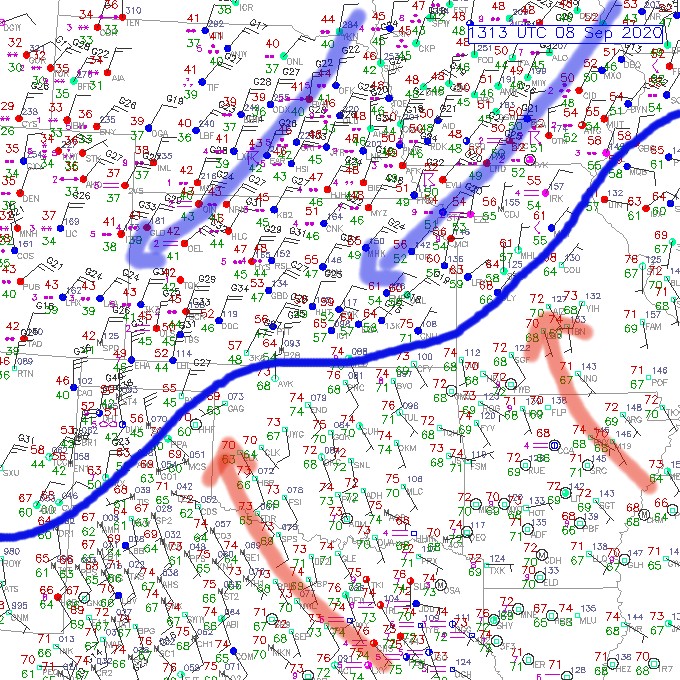
The 8AM surface map, with the temperatures in red show the colder air moving into the region from the IA/NE area. The blue line is the cold front and the weight of the cold air is helping to ooze that front southwards this morning.
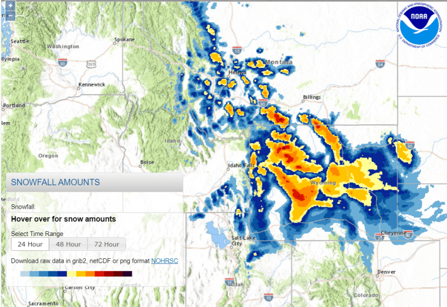
Back towards the west…where the colder air has moved into and through the central Rockies…it’s been snowing pretty good across WY…amounts have been pretty impressive in the higher elevations there especially.
This is all coming about because of a sharp storm that is digging into the Rockies and will, in time, weaken and come out into the western Plains region by later in the week.

You can see the storm digging through eastern UT this morning. It will slow to a crawl towards the 4 Corners region into Thursday before gradually filling and lifting out into the western Plains.
That means that the flow aloft will be out of the south or southwest…with the flow at the surface being from the north and northeast. It’s an “overrunning” pattern and typically would keep us trapped in clouds and moisture. Any little disturbance coming up from OK could trigger an area of chilly rain and that will be the case tomorrow night into Friday it appears. It won’t be a continuous rain but it will be off and on in the span.
With the clouds..occasional rains…and a north wind…tough for us to see much of a temperature change. There may be a few thin spots tomorrow and again on Friday and perhaps a couple of breaks in the clouds…but it’s a pretty gray next few days coming.

As far as the rain situation goes…yes..but not a ton today. We’ll have periodic showers as the front is to the south of here but at the same time the winds above the front will remain out of the SSW…every so often these winds will be a bit stronger above the front and that will lead to some extra lift and renewed showers/storms. Especially tomorrow night into Friday evening.

This crazy weather change for parts of the Rockies may actually help with the fire fighting efforts. There have been some pretty big fires in Colorado as well.
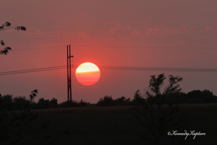
The feature photo of the day comes from Warren Kennedy out towards Grain Valley yesterday…of a very smokey sunset last night. This has been the case for days now as the devastating fires out west are sending abundant amounts of smoke through the country.
That’s it for today…stay warm! Funny to say that after all the heat and humidity lately.
Joe


