KANSAS CITY, Mo. — It’s been hotter this year versus last year. We can probably already tell that by how dry it’s been. After some rain the last couple of days, our next focus is on the heat.
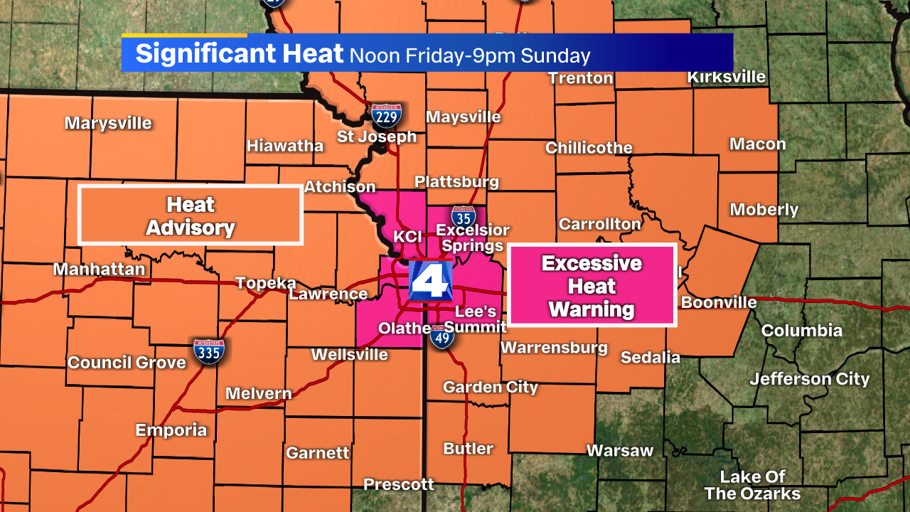
An Excessive Heat Warning and Heat Advisory goes into effect Friday midday through Sunday night.
I know what you’re saying: “It’s July. It’s supposed to be hot!” You’re right, but there are a few things that go into this criteria.
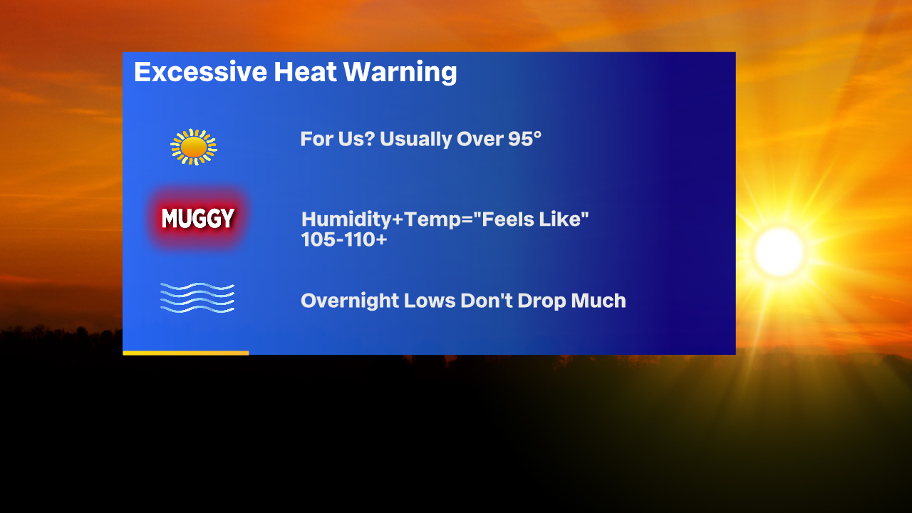
First of all, the National Weather Service issues these advisories, watches and warnings. While there is a loose criteria, above is what I think it usually takes for us to see the Excessive Heat headline issued for our region.
Usually our temperatures are over 95. I say usually because sometimes it’s so humid that it overcomes the air temperature and creates a very dangerous heat index (see headline 2). Humidity plus air temperature will make it feel between 105-110 this week.
If you noticed, the “core metro” counties are the only ones under this warning. The urban areas with pavement and buildings obviously get a little bit hotter. That’s the reason for this.
The last one, which we don’t think about as often, is the temp at night. When it doesn’t drop much below 80 (if at all), there’s not much of a recovery time for the body to cool off, and it immediately warms up quickly.
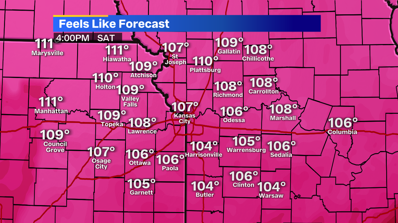
Saturday will probably be our hottest day with temperatures that feel over 110 in many spots.
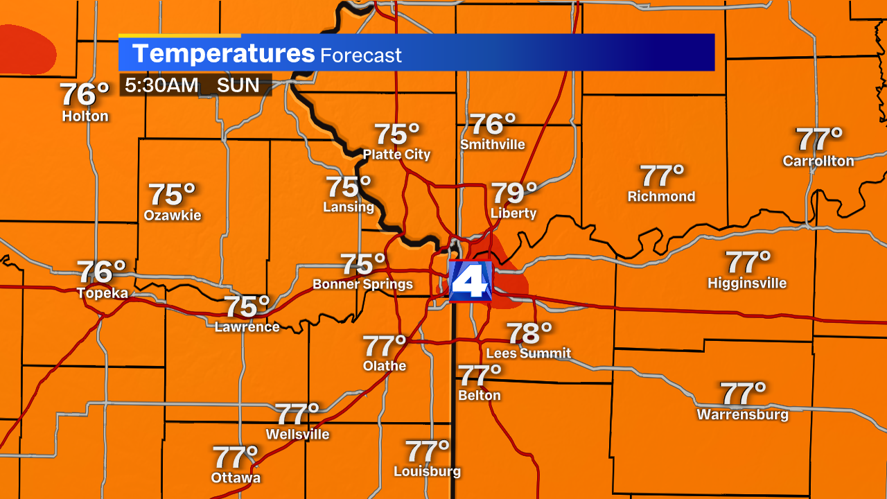
Temperatures early Sunday morning will briefly drop below 80. Cloud cover in the afternoon may keep us from getting too close to 100.
Take breaks inside if you can. Stay hydrated, and be weary of heat exhaustion! Temperatures come down on Monday with our next chance for rain.


