
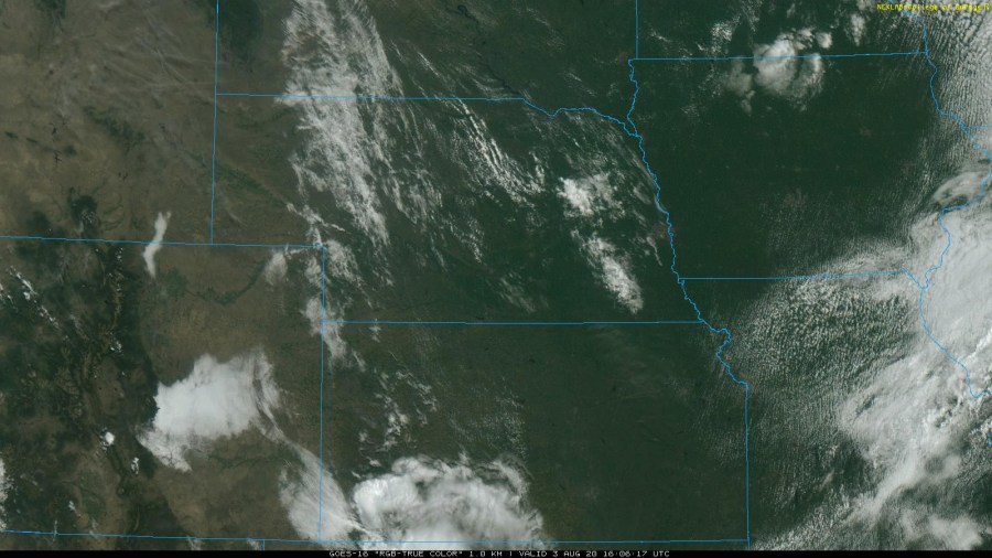
We’ve seen all types of different weather this summer, which, of course, is nothing new to the Kansas City area in June, July, and August. But, the whiplash over the past two months from a bone-dry (and hot) June to a soaking wet July has allowed some abnormally dry to moderate drought conditions to creep in, but also kept some green landscapes around the metro. Notice how green everything looks, thanks to abundant rainfall over the past couple of weeks.
Credit: COD Meteorology
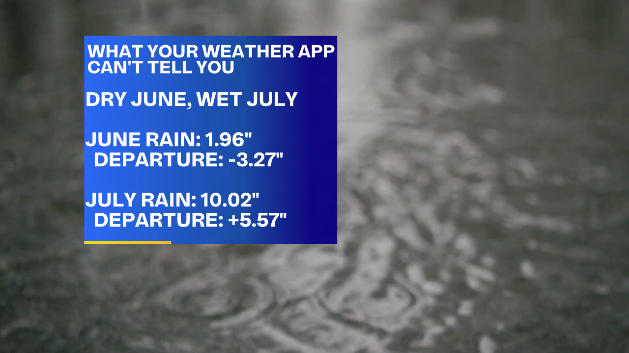
But before we take a deeper look into August, let’s circle back to the numbers from June and July. First, the month of June was a hot and dry one for Kansas City. The average mean temperature for the month (the average of 30 days or so of high and low temps) was 77.4 degrees, which was almost 4 degrees warmer than normal, giving this June the #5 spot on the all-time warmest Junes list for the metro. But, the lack of precip definitely packed more of a punch. KC only picked up 1.96″ of rain, which was well below the normal mark by 3.27 “. June 2020 was the 5th driest June we’ve ever had!
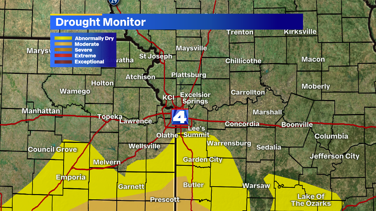
As you might imagine, we were dealing with some drought problems starting in June. Areas mainly south of I-70 and parts of southeastern Kansas were in some moderate drought while the immediate metro was mainly abnormally dry. Now, in early August, we’re noticing improvement, but not for everyone.
That improvement pretty much all came from the rounds of heavy rain/flash flooding we picked up on sporadically in July. There wasn’t consistent rain, which lead to good dry stretches leading to expanding drought, but when it did rain, it REALLY rained as spots under the downpours and storms picked up 3, 4, and 5+ inch totals!
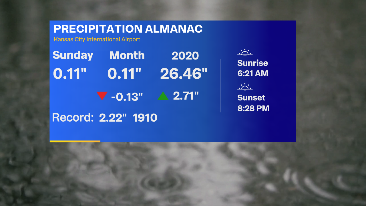
But now, in August, we’re actually near-normal for the start of the month. We picked just over 0.1″ Sunday, which was our first round of rain for the new month, and there are a few chances for more showers & storms towards the 2nd half of the work week and weekend.
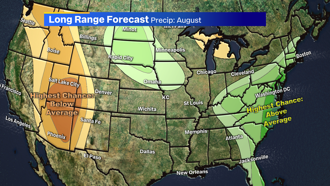
But how about for the rest of the month? Well, that’s always tough to put an exact number on total monthly precip for KC, but there’s some indication that areas north of I-70 may have some higher numbers than those to the south.
For what it’s worth, along with slight chances for a wetter August for some, it looks like some “cooler” days could pop back up at times between now and August 31st. Could that mean more 80s than 90s during what should be one of the hottest months of the calendar year? Time will truly tell.


