Storms in Nebraska and South Dakota will have a huge impact on our rain chances later Friday night/early Saturday morning.
As these storms continue to develop and move, that’s going to determine which direction they move, and who’s going to get rain!
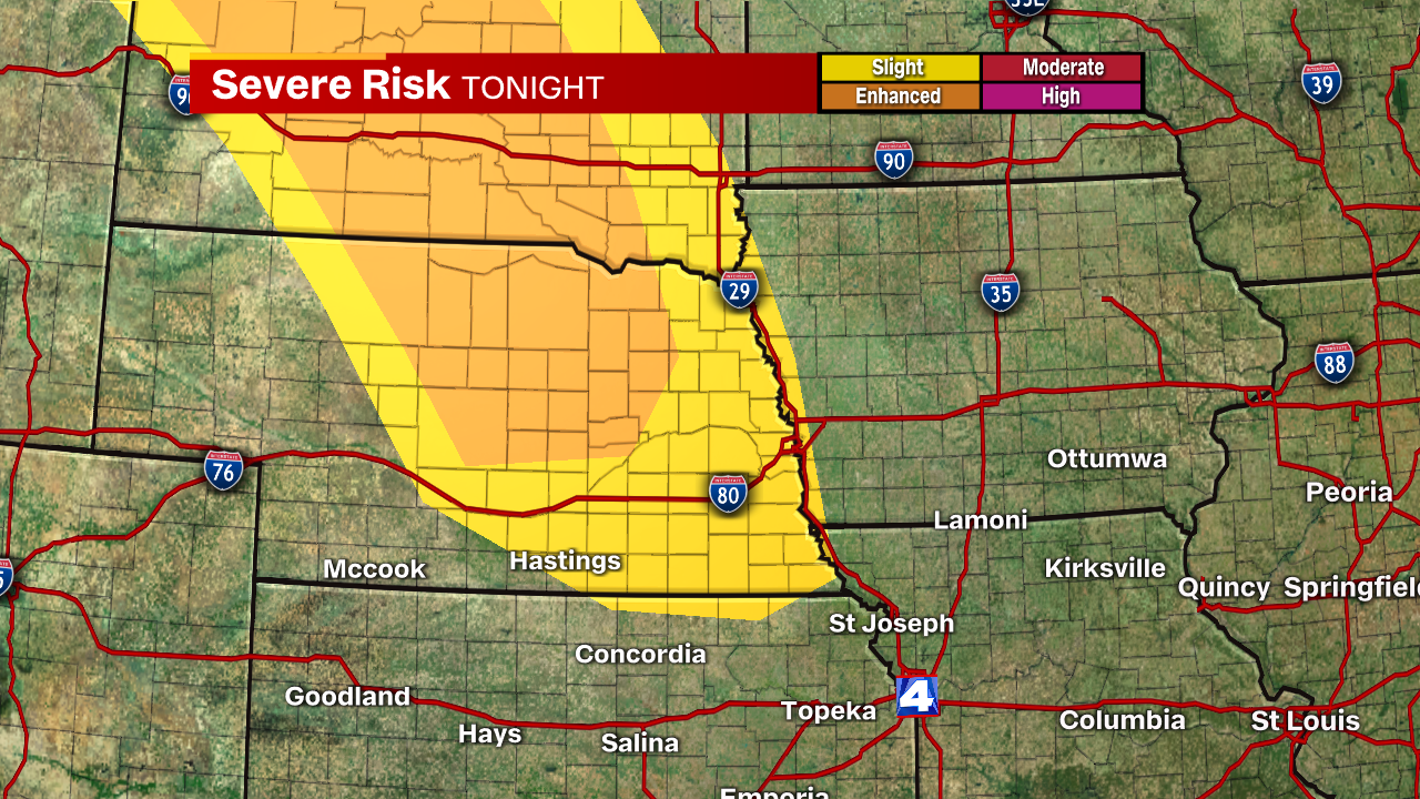
The Storm Prediction Center highlights Friday night’s severe threat for the areas that are currently under a Severe Thunderstorm Watch.
While the immediate metro isn’t under this severe risk, on the map above, it’s a good outline of how these storms will gradually weaken overnight.
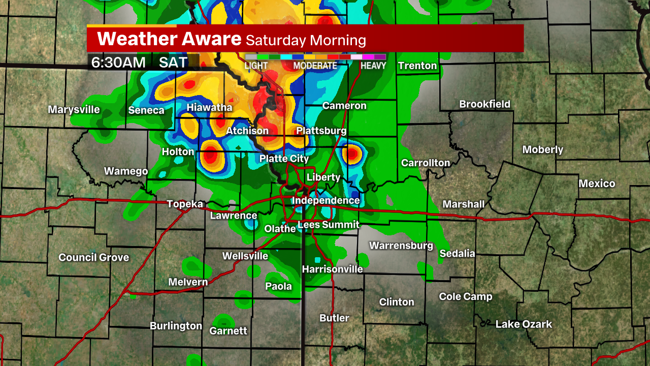
As the latest trends have suggested, these storms may take a bit longer to come together as one unit toward the metro area. That pushes the timeline back from the 1-3 AM suggested earlier this morning to a 6-9 AM time frame.
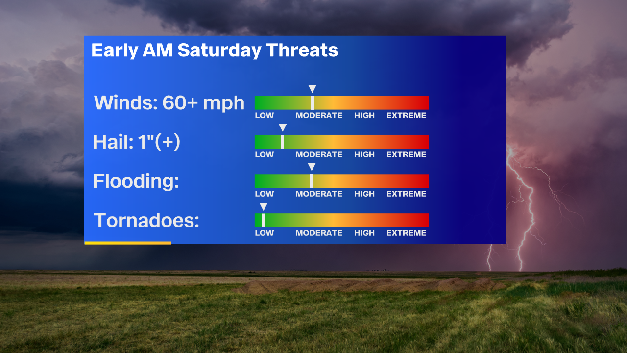
Gusty wind and smaller hail are going to be the main threats with a few of these storms early Saturday morning. Brief heavy rainfall could create some flooding issues for some of us as well.
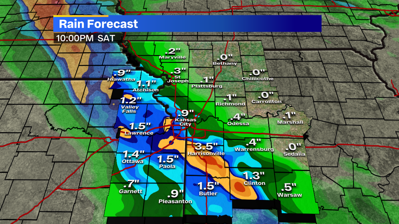
Even if the severe weather doesn’t materialize, there’s obviously the focus for who would get some heavy rain!
Depending on how this setup presents itself later tonight, some of us could get anywhere from nothing at all to over 2 inches in some isolated cases!
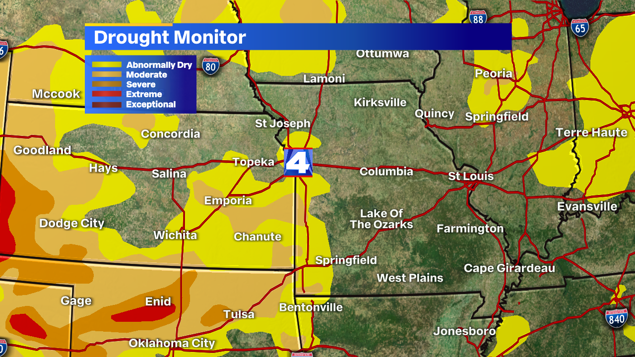
While some of us could miss out on this rain tonight, we’ll focus on the drought ahead. If we don’t get anything tonight, we’re likely going to see the drought intensify.
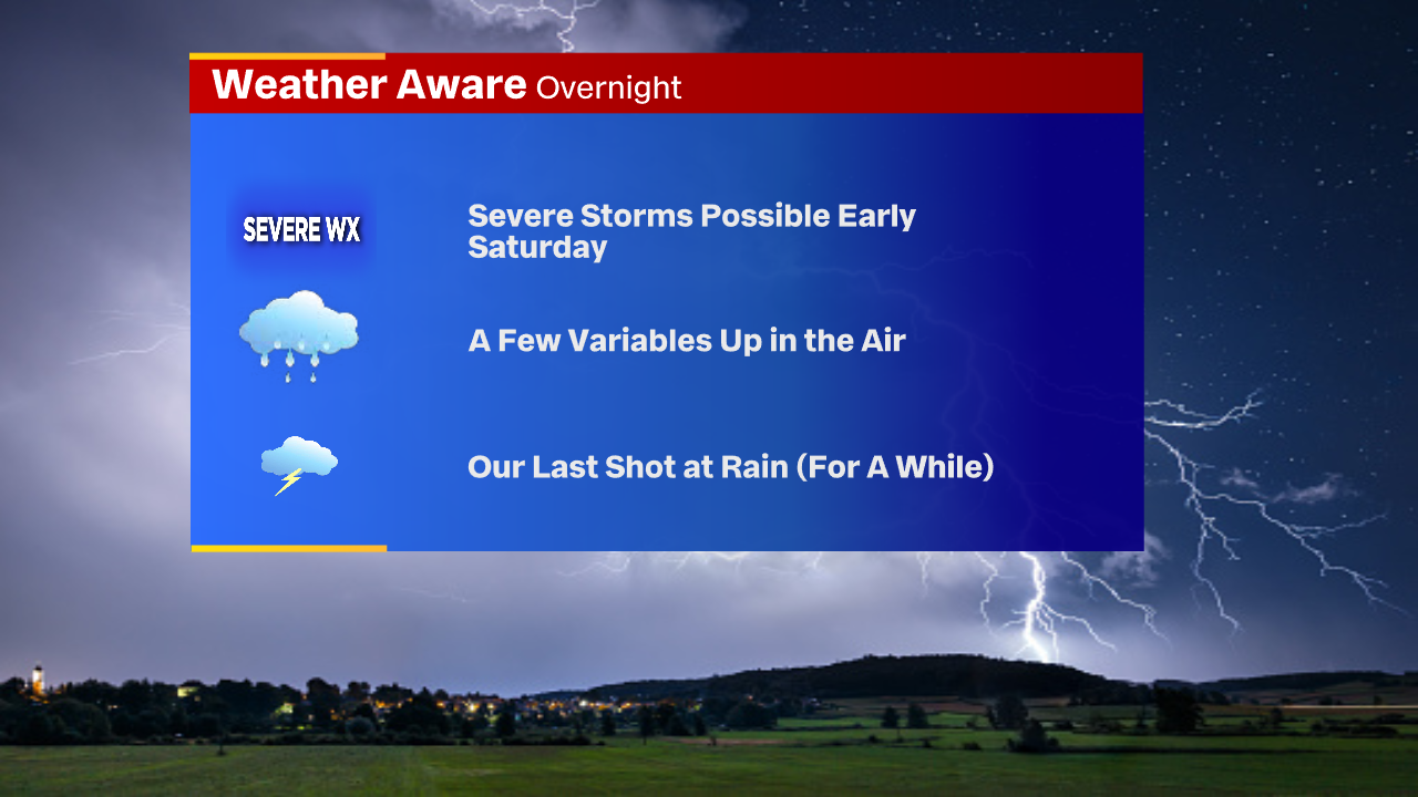
In summary, storms are still expected to impact us early Saturday. There are still a few variables up in the air regarding the development of these storms and how they impact us.
Make sure to check in with Joe on Friday night, especially at 9 and 10 PM. If we miss out on rain Saturday morning (some of us will,) it’s our last shot for a while. I’ll have updates for your early Saturday morning.


