
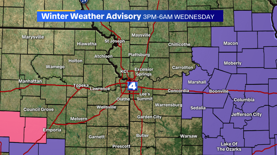
Kansas City, MO– Counties due east of Kansas City are under a Winter Weather Advisory this afternoon, through tonight, until 6 AM Wednesday, all thanks to some incoming light snow showers. The counties included are Carroll and Saline.
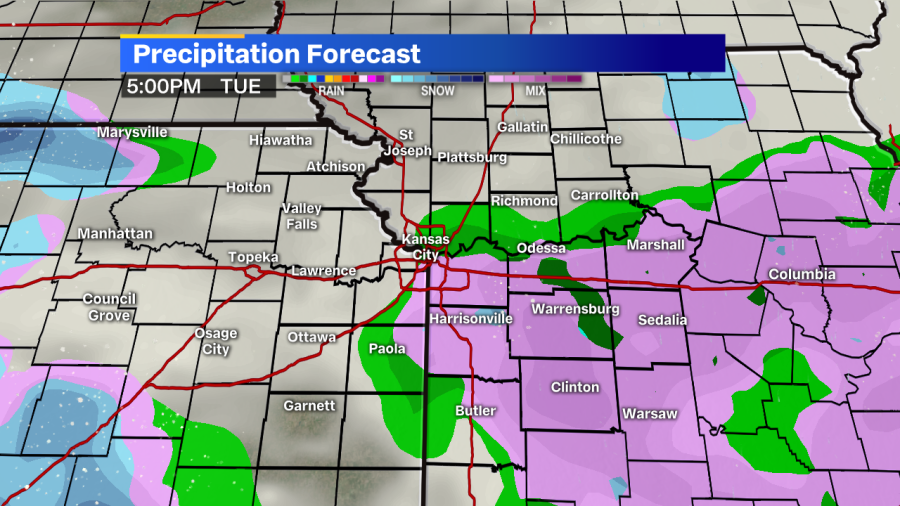
Rain showers this afternoon will be filling in for some portions of north central Missouri, and will move south throughout the afternoon. By the PM rush, areas just east of KC could see some light rain for the commute, but nothing worse. As the sun sets and temperatures continue falling from the 40s, a rain/snow mix will briefly take over before transitioning to all snow tonight.
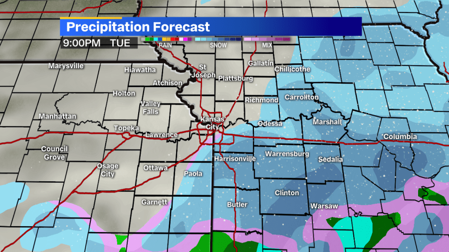
Light snow will continue on the Missouri side for most of the overnight hours, but we should start to see snow really break up as we get to the first couple of hours of the Wednesday AM drive back into work. By then, a light dusting of snow (at the absolute most) is possible inside the 435 loop and on the Kansas side.
Farther east of Kansas City, totals could start to climb closer to the 1-2″ range well east of town, in central and eastern Missouri.
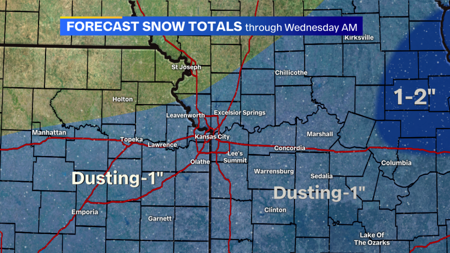
It’s important to note that whatever does stick on the ground will be on the grass, bridges, and other elevated surfaces. Main roads and highways will most likely stay wet, thanks to recent warm weather over the past weekend keeping the pavement above 32 degrees. But, some side streets, while wet, may have an icy patch.
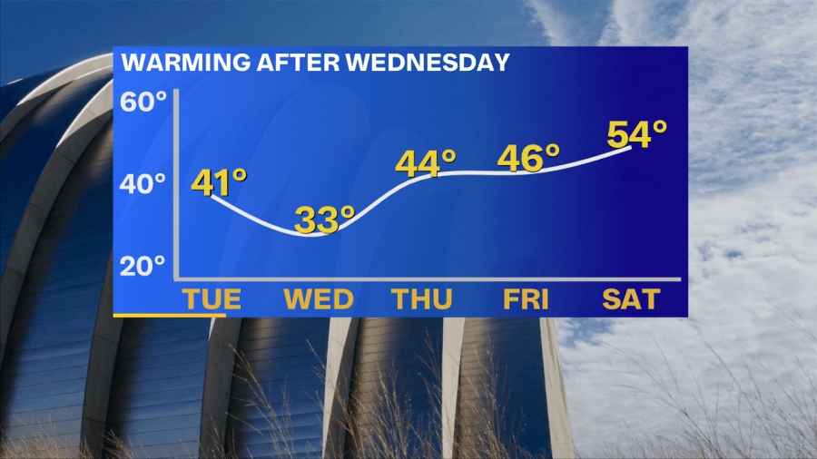
After the snow ends Wednesday morning, we’ll see the clouds move away with a chilly high just above freezing. High temperatures will actually be warming Thursday through the weekend, where we’ll see the 50s and 60s return (again), just in time to start March on Sunday.


